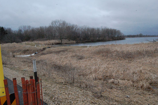
Vern Wolfe Lake is at the right, with the dam to the left. Highway 75 is farther left. This view is looking south.
A hole in the Vern Wolf Lake Dam detected this morning by Department of Natural Resources dam safety engineers is why DNR officials are concerned about the structure possibly failing and flooding or undermining near-by Highway 75.
DNR Warden Jennifer Niemeyer said the level of water in the lake is high but the real concern is that the hole has compromised the dam. The area has had rain most of this week and experienced sizable snow melt before that. The Fox River, farther west in Kenosha County, has reached a level today equal to the fifth highest level on record — 13.33 feet as of 2:15 p.m.
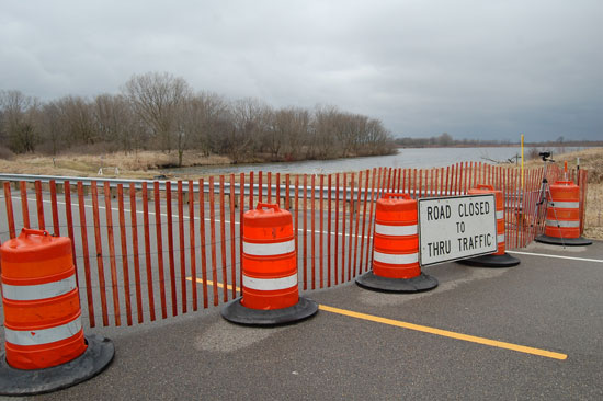
Because of the concerns about the dam, Highway 75 has been closed just south of Highway 75. The area is being monitored by sheriff’s deputies for the first 24 hours and will be monitored by DNR staff after that, Niemeyer said.
The road was closed this afternoon and will remain closed until officials determine the danger has passed, a statement issued by the Sheriff’s Department said.
Traffic on Highway 75 is being diverted at Highway JB from the south and at Highway 142 from the north.
Around the clock surveillance will continue for at least the next week, Niemeyer said.
“Our worries now are for the weather forecast for the next few days,” Niemeyer said. “We have rain forecasted every day, which is not going to help our situation.”
Dam safety engineers will be back out in a few days to reassess the situation, Niemeyer said.
There are no structures in the immediate area of the dam, other than the road. The dam now drains into a low lying farm field, however a dam failure could cause water to reach Brighton Creek, which flows much farther south.
“This dam is considered a very large dam for this area, but it’s considered a low impact dam, meaning if it were to go, it would have very little to no impact on the public,” Niemeyer said.
Here is video of the scene, including showing how forcefully the water is flowing from the dam’s outlet:
Here is video of Niemeyer speaking to media representatives at the scene (some strong wind noise on this — DH):
Here are some more photos:
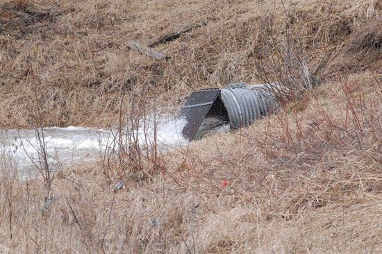
The dam outlet on the west side of Highway 75, the same side as the dam.
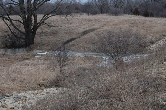
The east side of Highway 75 at the dam.
Related posts